
(Source: U.S.G.S Water Supply Paper 1849)
|
Clark Fork at Missoula, Montana |
|
12-3405 |
|
Lat 46°52'40'', long 113°55'40'', in NW 1/4 NW 1/4 sec. 19, T. 13 N., R. 18W., on right bank 3 miles downstream from Blackfoot River and 3 miles east of Missoula. Section 1 is 405ft upstream from gage. |
|
5,999 sq mi |
|
May 23, 1948 |
|
13.07 ft at gage; 14.54 ft at section 1 |
|
31.500 cfs |
|
Manning n = 0.030 |
|
Bed is composed of sand, gravel, and boulders; d50 = 175 mm, d84 = 325 mm. Thick undergrowth is along right bank and along the left bank in the lower part of the reach. |
Introduction Page || Site Description || Reach Properties
|
|
(sq ft) |
Width (ft.) |
depth (ft) |
radius (ft) |
velocity (ft per sec) |
between sections |
between sections |
|
|
|
|
|
|
|
|
|
|
|
|
|
|
|
|
|
|
|
|
|
|
|
|
|
|
|
|
4 |
3,798 |
312 |
12.17 |
11.95 |
8.29 |
297 |
.18 |
Introduction Page || Site Description || Reach Properties
Plan Sketch and Cross Sections || Site Photos

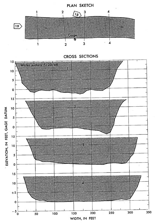
Plan sketch and cross sections, Clark Fork above Missoula, Montana.
Plan Sketch and Cross Sections || Site Photos

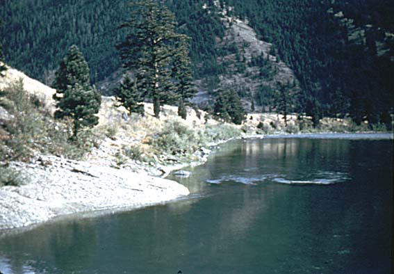
Photo 18: Downstream along left bank from above section 3, Clark Fork above Missoula, Montana.
Photo 19: Downstream through reach from bridge 400 ft above section 1, Clark Fork above Missoula, Montana.
Introduction Page || Site Description || Reach Properties
Plan Sketch and Cross Sections || Site Photos