|
|
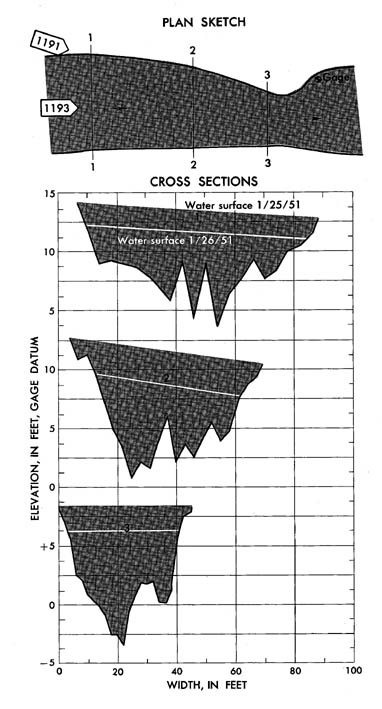
Cache Creek near Lower Lake, California
|
|
|
11-4510
|
|
|
Lat 38 55'27'', long
12233'53'', in sec. 6, T. 12 N.,
R. 6 W., on left bank 500 ft downstream from Clear Lake Dam, 1.9 miles
downstream from Copsey Creek, and 2.5 miles northeast of Lower Lake. Section
1 is 350 ft upstream from gage. 55'27'', long
12233'53'', in sec. 6, T. 12 N.,
R. 6 W., on left bank 500 ft downstream from Clear Lake Dam, 1.9 miles
downstream from Copsey Creek, and 2.5 miles northeast of Lower Lake. Section
1 is 350 ft upstream from gage.
|
|
|
528 sq mi
|
|
|
January 24-25, 1951
|
|
|
7.80 ft at gage, 6.30 ft at gage; 13.35 ft, 11.70 ft at section
1
|
|
|
3,840 cfs, 1,830 cfs
|
-
Computed roughness coefficient
|
Manning n = 0.053; 0.079
|
|
|
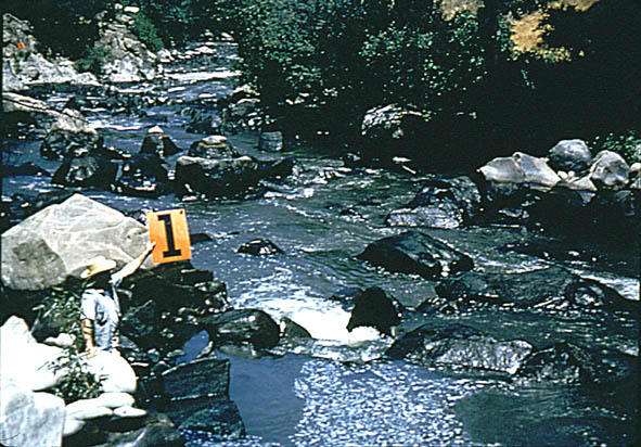
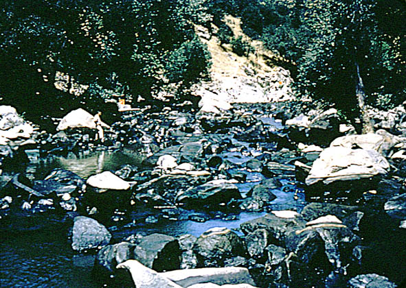
Bed is composed of large angular boulders. Banks consist
of exposed rock, boulders, and trees.
|