
(Source: U.S.G.S Water Supply Paper 1849)
|
Columbia River at Vernita, Washington |
|
12-4645 |
|
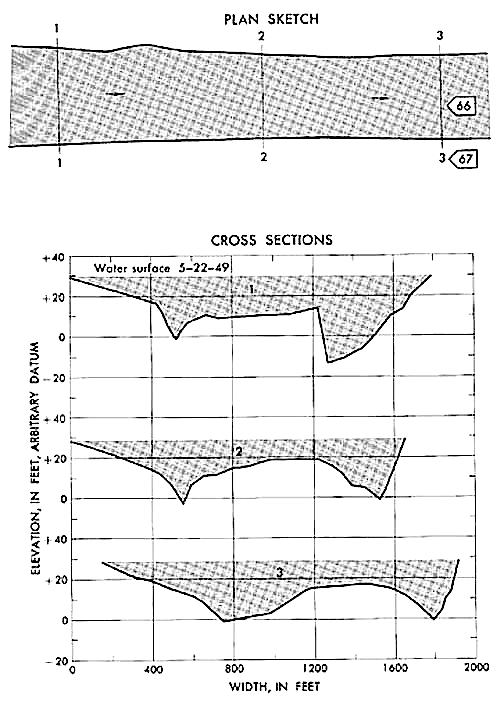
In sec. 11, T. 13 N., R. 24 E., at the Richmond ferry site, 0.5 mile north of Vernita station. Gage operated 50 miles upstream of station called Columbia River at Triniday, Wash. Section 1 is 5,000 feet upstream from cableway at Vernita gage. |
|
89,700 sq mi |
|
May 22, 1949 |
|
48.33 ft at Trinidad gage: 29.5 ft (different datum) at section 1. |
|
406,000 cfs |
|
Manning n = 0.024 |
|
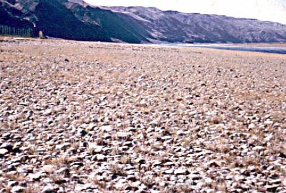
Bed consists of slime-covered cobbles and gravel. The straight and steep left bank is composed of cemented cobbles and gravel. The gently sloping right bank consists of cobbles set in gravel and is free of vegetation. |
Introduction Page || Site Description || Reach Properties
|
|
(sq ft) |
Width (ft.) |
depth (ft) |
radius (ft) |
velocity (ft per sec) |
between sections |
between sections |
|
|
|
|
|
|
|
|
|
|
|
|
|
|
|
|
|
|
|
|
|
|
|
|
|
|
|
Introduction Page || Site Description || Reach Properties
Plan Sketch and Cross Sections || Site Photos

Plan sketch and cross sections, Columbia River at Vernita, Washington.
Introduction Page|| Site Description || Reach Properties
Plan Sketch and Cross Sections || Site Photos

Introduction Page || Site Description || Reach Properties
Plan Sketch and Cross Sections || Site Photos