
(Source: U.S.G.S Water Supply Paper
1849)
|
Clark Fork at St. Regis, Montana |
|
12-3545 |
|
Lat 47°18'05'', long 115°05'15'', in center of SW 1/4 sec. 19, T. 18 N., R. 27 W., on left bank at St. Regis. 0.5 mile downstream from St. Regis River. Section 1 is 660 ft upstream from gage. |
|
10,709 sq mi |
|
May 24, 1948 |
|
19.96 ft at gage: 20.42 ft at section 1 |
|
68,900 cfs |
|
Manning n = 0.028 |
|
Bed consists of well-rounded boulders; d50 = 135 mm, d84 = 205 mm. Banks are composed of gravel and boulders, and have tree and brush cover. |
Introduction Page || Site Description || Reach Properties
|
|
(sq ft) |
Width (ft.) |
depth (ft) |
radius (ft) |
velocity (ft per sec) |
between sections |
between sections |
|
|
|
|
|
|
|
|
|
|
|
|
|
|
|
|
|
|
|
|
|
|
|
|
|
|
|
Introduction Page || Site Description || Reach Properties
Plan Sketch and Cross Sections || Site Photos
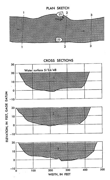
Plan sketch and cross sections, Clark Fork at St. Regis, Montana.
Plan Sketch and Cross Sections || Site Photos
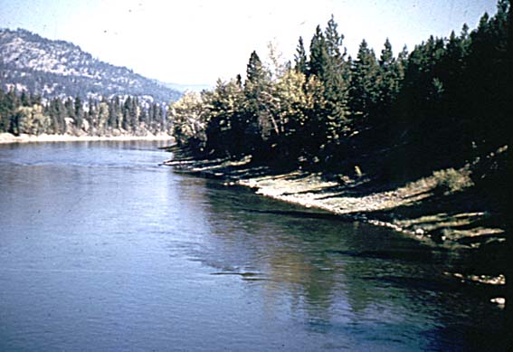
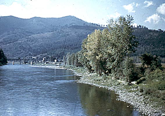
Photo 22: Downstream along right bank from section 2, Clark Fork at St. Regis, Montana.
Photo 23: Upstream along left bank from section 2, Clark Fork at St. Regis, Montana.
Introduction Page || Site Description || Reach Properties
Plan Sketch and Cross Sections || Site Photos