
(Source: U.S.G.S Water Supply Paper 1849)
|
Salt River below Stewart Mountain Dam, Arizona |
|
9-5020 |
|
Lat 30°33'00'', long 111°34'31'', in N 1/2 NW 1/4 sec. 6, T. 2N., R. 8 E. (unserveyed), on left bank 3.5 miles downstream from Stewart Mountain Dam and 6 miles upstream from Verde River. Section 1 is about 2.25 miles downstream from gage. |
|
6,230sq mi, of which 21 sq mi is below Stewart Mountain Dam. |
|
Mar. 24, 1950 |
|
4.26 ft at gage; 99.26 ft (different datum) at section 1 |
|
1,280 cfs |
|
Manning n = 0.032 |
|
Bed and banks consist of smooth cobbles 4 to 10 inches in diameter, average diameter about 6 inches. A few boulders are as much as 18 inches in diameter. |
Introduction Page || Site Description || Reach Properties
|
|
(sq ft) |
Width (ft.) |
depth (ft) |
radius (ft) |
velocity (ft per sec) |
between sections |
between sections |
|
|
|
|
|
|
|
|
|
|
|
|
|
|
|
|
|
|
|
|
|
|
|
|
|
|
|
|
4 |
449 |
194 |
2.3 |
2.30 |
2.86 |
294 |
.31 |
|
5 |
420 |
204 |
2.1 |
2.06 |
3.05 |
370 |
.63 |
|
6 |
381 |
207 |
1.8 |
1.84 |
3.36 |
333 |
.72 |
|
7 |
308 |
191 |
1.6 |
1.61 |
4.16 |
314 |
1.06 |
Introduction Page || Site Description || Reach Properties
Plan Sketch and Cross Sections || Site Photos

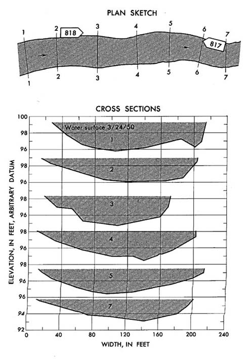
Plan sketch and cross sections, Salt River below Stewart Mountain Dam, Arizona.
Plan Sketch and Cross Sections || Site Photos

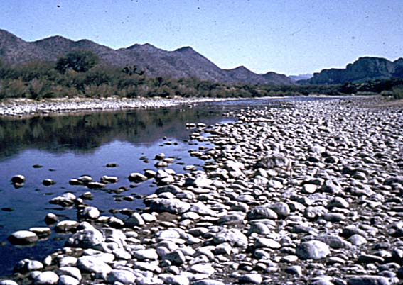
Photo 817: Upstream along left bank from below section 6, Salt River below Stewart Mountain Dam, Arizona.
Photo 818: Downstream along left bank from section 2, Salt River below Stewart Mountain Dam, Arizona.
Introduction Page || Site Description || Reach Properties
Plan Sketch and Cross Sections || Site Photos