
(Source: U.S.G.S Water Supply Paper
1849)
|
Clearwater River at Kamiah, Idaho |
|
13-3390 |
|
Lat 46°14', long 116°01', in sec. 1, T. 33 N., R. 3 E., on left bank 0.25 mile downstream from highway bridge at Kamiah, 0.75 mile downstream from Lawyer Creek, and 6 miles downstream from South Fork. Section 1 is about 5.8 miles downstream from gage. |
|
4,850 sq mi, approximately. |
|
May 29, 1948 |
|
19.22 ft at gage: 46.17 ft at section 1 |
|
99,000 cfs |
|
Manning n = 0.033 |
|
Bed is composed of gravel and boulders with some exposed bedrock. Channel is bordered by railroad on the right and highway on the left. Banks are gravel and rock and have light vegetation. |
Introduction Page || Site Description || Reach Properties
|
|
(sq ft) |
Width (ft.) |
depth (ft) |
radius (ft) |
velocity (ft per sec) |
between sections |
between sections |
|
|
|
|
|
|
|
|
|
|
|
|
|
|
|
|
|
|
|
|
|
|
|
|
|
|
|
Introduction Page || Site Description || Reach Properties
Plan Sketch and Cross Sections || Site Photos
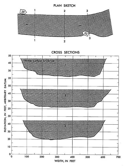
Plan sketch and cross sections, Clearwater River at Kamiah, Idaho
Plan Sketch and Cross Sections || Site Photos
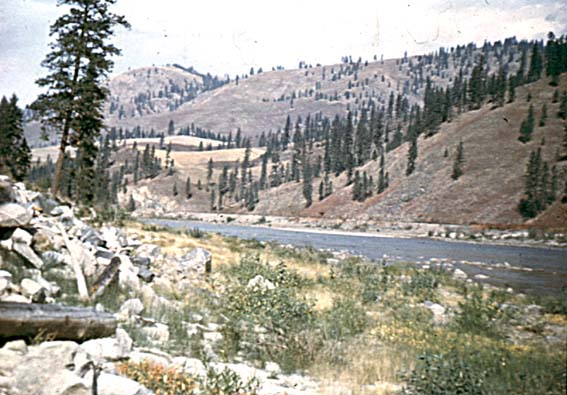
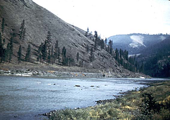
Photo 29: Downstream along left bank from above section 1, Clearwater River at Kamiah, Idaho.
Photo 32: Upstream from left bank at section 3, Clearwater River at Kamiah, Idaho.
Introduction Page || Site Description || Reach Properties
Plan Sketch and Cross Sections || Site Photos