
(Source: U.S.G.S Water Supply Paper
1849)
|
Wenatchee River at Plain, Washington |
|
12-4570 |
|
Lat 47°45'50'', long 120°39'30'', in lot 8, sec. 12, T. 26 N., R. 17 E., on left bank at Plain, 0.25 mile downstream from Beaver Creek, 7.5 miles downstream from Nason Creek, and 12 miles north of Leavensworth. Section 1 is about 1,360 ft upstream from gage. |
|
591 sq mi. |
|
May 29, 1948 |
|
12.43 ft at gage: 16.50 ft at section 1 |
|
22,700 cfs |
|
Manning n = 0.037 |
|
Bed is boulders; d50 = 162 mm, d85 = 320 mm. Bank are lined with trees and bushes. |
Introduction Page || Site Description ||
Reach Properties
|
|
(sq ft) |
Width (ft.) |
depth (ft) |
radius (ft) |
velocity (ft per sec) |
between sections |
between sections |
|
|
|
|
|
|
|
|
|
|
|
|
|
|
|
|
|
|
|
|
|
|
|
|
|
|
|
Introduction Page || Site Description || Reach Properties
Plan Sketch and Cross Sections || Site Photos

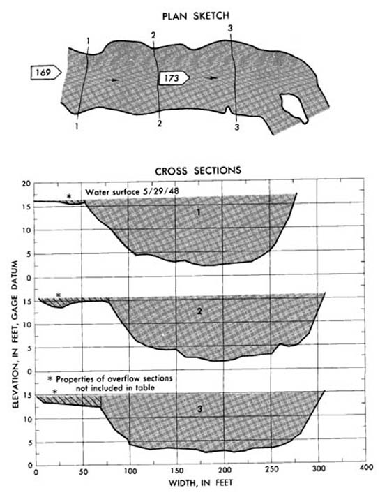
Plan and cross sections, Wenatchee River at Plain, Washington.
Plan Sketch and Cross Sections || Site Photos

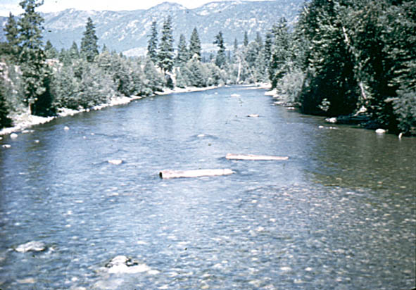
Photo 169: Downstream from above section 1, Wenatchee River at Plain, Washington.
Photo 173: Downstream from section 2, Wenatchee River at Plain, Washington.
Introduction Page || Site Description || Reach Properties
Plan Sketch and Cross Sections || Site Photos