
(Source: U.S.G.S Water Supply Paper 1849)
|
Spokane River at Spokane, Washington |
|
12-4225 |
|
Lat 47°39'35'', long 117°26'50'', in SW 1/4 sec. 13, T. 25 N., R. 42 E., on right bank at Cochran street in Spokane, 0.5 mile upstream from Latah Creek. Section 1 is about 800 ft upstream from gage. |
|
4,290 sq mi. |
|
May 31, 1948 |
|
28.35 ft at gage: 29.37 ft at section 1. |
|
39,600 cfs |
|
Manning n = 0.038 |
|
Bed is gravel and boulders; d50 = 195 mm, d84 = 360 mm.Banks are lined with trees and brush. |
Introduction Page || Site Description || Reach Properties
|
|
(sq ft) |
Width (ft.) |
depth (ft) |
radius (ft) |
velocity (ft per sec) |
between sections |
between sections |
|
|
|
|
|
|
|
|
|
|
|
|
|
|
|
|
|
|
|
|
|
|
|
|
|
|
|
|
|
|
|
|
|
|
|
|
Introduction Page || Site Description || Reach Properties
Plan Sketch and Cross Sections || Site Photos

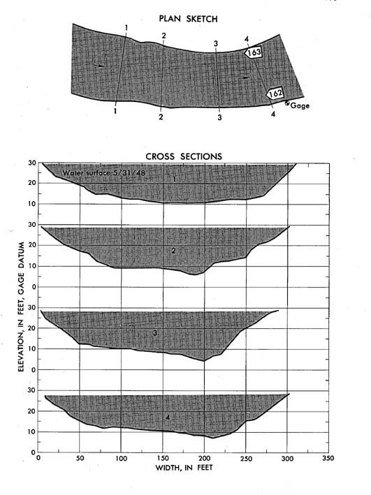
Plan and cross sections, Spokane River at Spokane, Washington.
Plan Sketch and Cross Sections || Site Photos

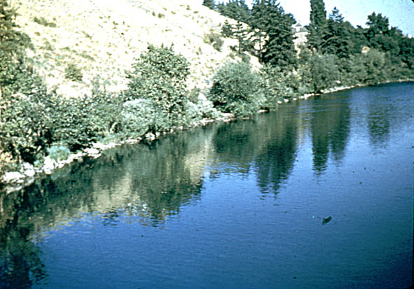
Photo 162: Upstream along right bank from section 4, Spokane River at Spokane, Washington.
Photo 163: Upstream along left bank from section 4, Spokane River at Spokane, Washington.
Introduction Page || Site Description || Reach Properties
Plan Sketch and Cross Sections || Site Photos