|
|
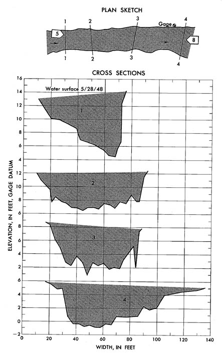
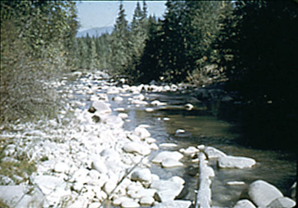
Boundary Creek near Porthill, Idaho
|
|
|
12-3215
|
|
|
Lat 48°59'50'', long 116°34'05'', in SW 1/4 sec.
11, T. 65 N., R. 2 W., on left bank near muoth of canyon 0.2 mile south
of international boundary, and 3 miles west of Porthill. Section 1 is about
413 ft upstream from gage.
|
|
|
97 sq mi, approximately. |
|
|
May 28, 1948
|
|
|
5.34 ft at gage; 13.60 ft at section 1
|
|
|
2,530 cfs
|
-
Computed roughness coefficient
|
Manning n = 0.073
|
|
|
Bed consists of boulders; d50
= 210 mm, d84 = 375mm. Banks are
composed of boulders and have trees and brush along top.
|